

Wednesday, March 26, 2014 - Page updated at 01:30 PM
Interactive: Before and after the Highway 530 mudslide
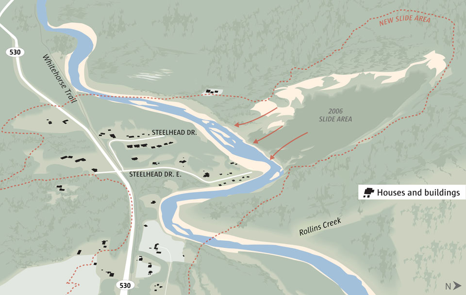
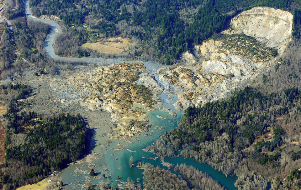
Photo by Ted S. Warren /The Associated Press; Graphic by The Seattle Times
BEFORE AND AFTER: This aerial photograph shows the devastation Monday afternoon near Oso, Snohomish County. In this view to the west, Highway 530 runs along the Stillaguamish River -- until the highway disappears into the debris field. The pile of mud and debris at center, 20 feet deep or more in some areas, blankets Steelhead Drive and surrounding homes. On the other side of the river, which is cutting a new channel, stands the cliff that was left behind, 1,500 feet wide and 600 feet tall. For more information, read the story.